
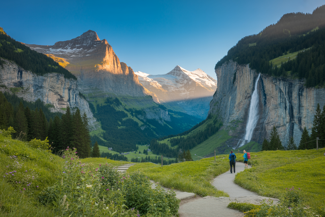
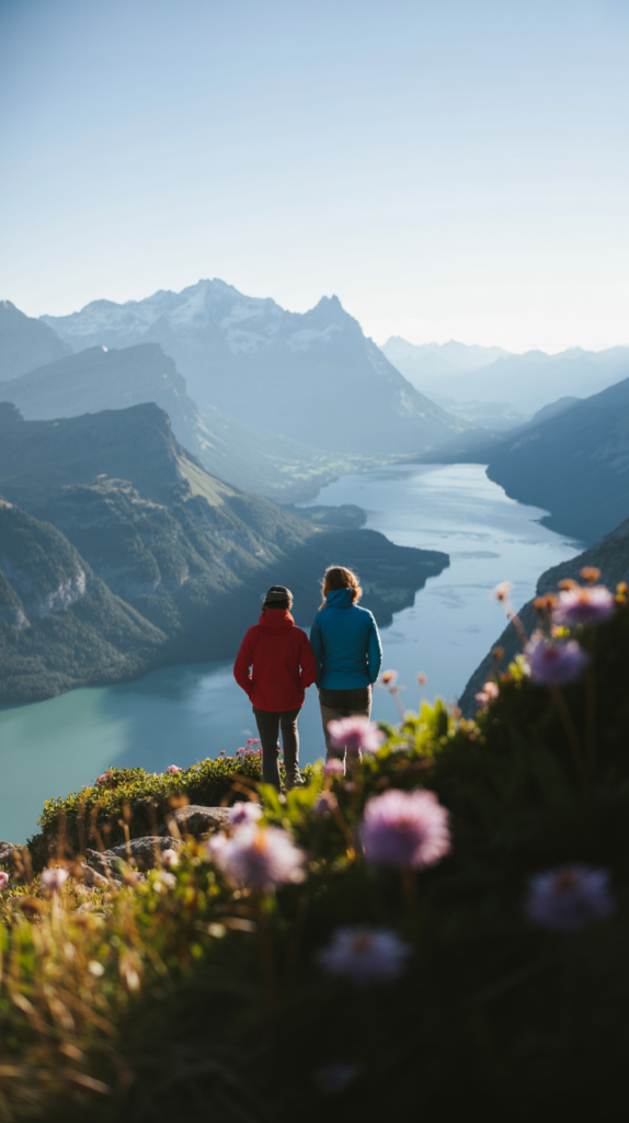
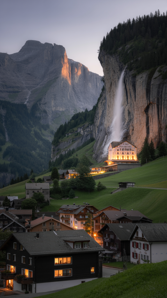
If you’ve ever dreamed of stepping into a real-life fairy tale, Lauterbrunnen is where that dream becomes reality.
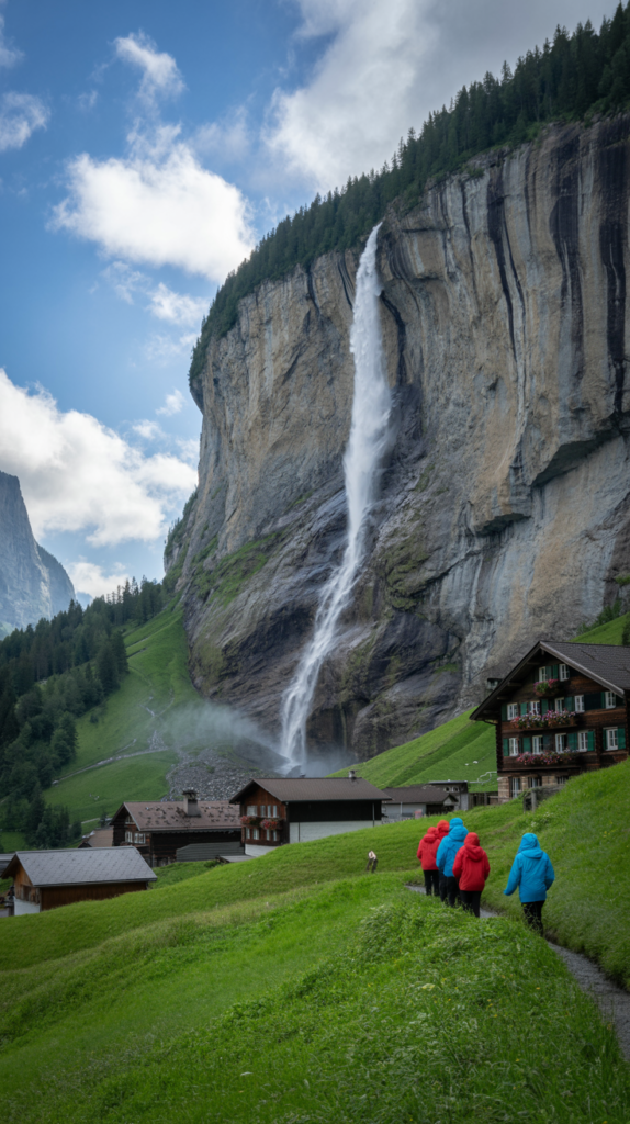
Tucked in the Bernese Oberland of Switzerland, this picturesque valley is home to 72 waterfalls, alpine meadows, quaint Swiss chalets, and some of the most breathtaking mountain views in the world.
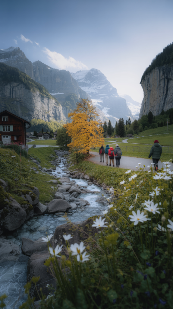
Often called “the valley of waterfalls,” Lauterbrunnen attracts travelers who crave not just beauty, but also adventure and nothing immerses you deeper into its charm than hiking.
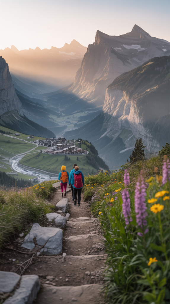
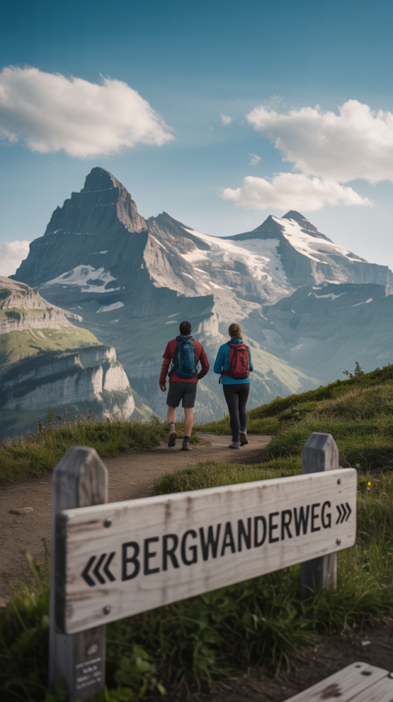
From gentle valley walks to high-altitude alpine treks, Lauterbrunnen offers trails for every level of hiker.
Whether you want a casual stroll past waterfalls or a challenging hike with sweeping views of the Eiger, Mönch, and Jungfrau peaks, you’ll find a trail that suits your style.
This guide to the 9 best hiking trails in Lauterbrunnen, Switzerland will give you everything you need: how to reach each trail, the best times to go, distances and difficulty levels, costs, safety tips, essential gear, food and water preparation, and insider advice from experienced hikers.
By the end, you’ll be ready to lace up your boots and create unforgettable memories in this alpine paradise.
shop my amazon essential
- Sturdy Hiking Boots
- Lightweight Backpack
- Trekking Poles
- Reusable Water Bottle
- Sunglasses
- First Aid Kit
- Insect repellent
- Lightweight Gloves
- Emergency Whistle
- Compact Flashlight
- Lightweight Trekking Gaiters
How to Get to Lauterbrunnen
Reaching Lauterbrunnen is straightforward, whether you’re traveling from within Switzerland or flying in from abroad.
- By Air: The closest major airport is Zurich International Airport (ZRH), about 140 km (87 mi) away. From Zurich, it takes roughly 2.5 hours to reach Lauterbrunnen by train or car. Another option is Bern Airport (BRN), about 70 km (43 mi) away, but it has fewer international connections.
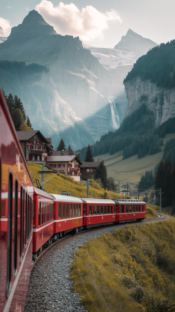
- By Train: Switzerland’s rail system is one of the best in the world. From Zurich, you can take a direct train to Interlaken Ost, then transfer to a regional train that takes you into the heart of Lauterbrunnen Valley. The journey is scenic, passing lakes, mountains, and charming villages.
- By Car: Driving is also possible. From Zurich, take the A8 motorway towards Interlaken, then follow signs to Lauterbrunnen. Parking is limited in the valley, especially in summer, so using trains is often more convenient.
- From Interlaken: Lauterbrunnen is just 20 minutes away by train. Many hikers base themselves in Interlaken for wider accommodation choices but head into Lauterbrunnen daily for hiking.
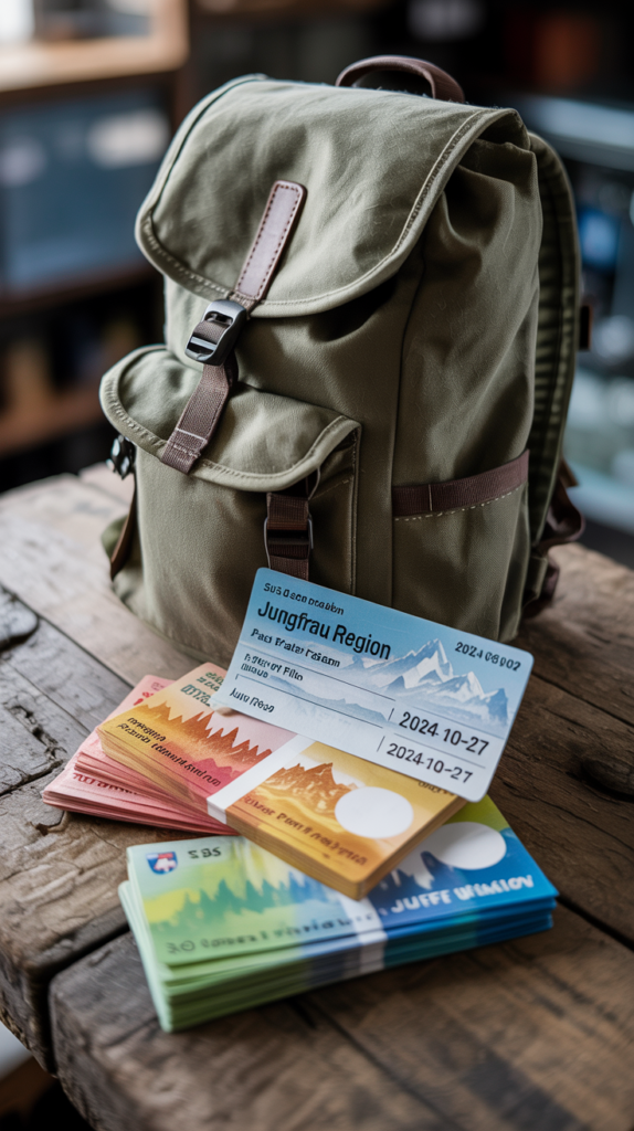
Pro Tip: If you plan to hike extensively in the Jungfrau Region (which includes Lauterbrunnen, Wengen, Mürren, and Grindelwald), consider buying the Swiss Travel Pass or the Jungfrau Travel Pass.
These passes give unlimited travel on trains, buses, and cable cars in the area, saving you both time and money.
Best Time to Go Hiking in Lauterbrunnen
The hiking season in Lauterbrunnen depends on weather conditions and snow levels at higher altitudes.
- Summer (June – September): This is the prime hiking season. Trails are clear of snow, alpine meadows are in full bloom, and waterfalls are at their strongest. Expect more crowds in July and August.
- Spring (April – May): Lower valley trails are accessible, but higher ones may still be snow-covered. Great for seeing waterfalls at their peak flow.
- Autumn (October): Cooler temperatures, fewer tourists, and colorful alpine foliage make this a magical time to visit. Some cable cars may begin seasonal closures.
- Winter (November – March): Most hiking trails are closed or unsafe due to snow, but winter walking paths and snowshoeing options are available.
Pro Tip: Always check the weather forecast before heading out. Sudden changes in mountain weather are common, and storms can roll in quickly.
Safety & Choosing the Safest Hiking Path
While Lauterbrunnen’s trails are well-marked and maintained, safety should always be your top priority.
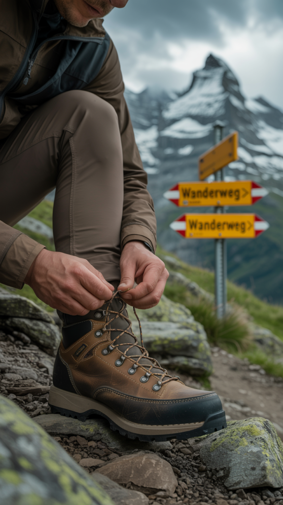
- Stick to official hiking paths (marked with yellow or red trail signs).
- Wear proper footwear—good-quality hiking boots with ankle support are essential.
- Carry a map or offline GPS app like Maps.me or Komoot. Cell service can be patchy in the mountains.
- Start hikes early to avoid afternoon storms.
- Respect altitude changes; if you’re not acclimatized, avoid pushing too hard on high trails.
For beginners, the Lauterbrunnen Valley Waterfall Trail and Wengen Panorama Trail are the safest and most scenic options.
For more advanced hikers, Schilthorn via Mürren and Kleine Scheidegg to Eiger Trail are thrilling but require stamina and preparation.
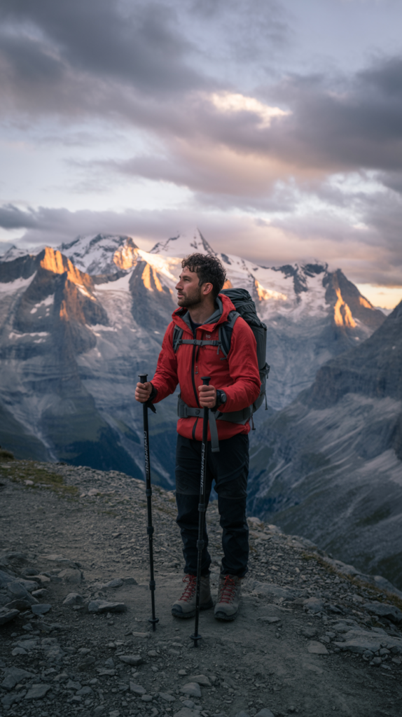
Essentials Hiking Tips for Lauterbrunnen
- Layered Clothing: Swiss mountain weather changes rapidly. Dress in moisture-wicking layers, carry a rain jacket, and pack a warm fleece.
- Hydration: Bring at least 2 liters (68 oz) of water. Mountain streams are often safe, but not always guaranteed.
- Snacks: Energy bars, nuts, and dried fruit keep your energy up during long hikes.
- Sun Protection: Sunglasses, sunscreen, and a hat are crucial, even on cloudy days.
- Trail Etiquette: Yield to uphill hikers, don’t leave trash, and respect local farmers’ land.
- Cash: Some mountain huts and cable car stations only accept cash (Swiss Francs).
The 9 Best Hiking Trails in Lauterbrunnen
Now let’s dive into the heart of this guide: the nine most spectacular hiking trails you can experience in Lauterbrunnen. Each trail comes with distance, duration, difficulty, highlights, and tips.
1. Lauterbrunnen Valley Waterfall Trail (Staubbach Falls & Trümmelbach Falls)
Distance: 8 km (5 mi) round trip
Duration: 2–3 hours
Difficulty: Easy
Starting Point: Lauterbrunnen village
Highlights: Staubbach Falls, Trümmelbach Falls, alpine meadows, classic valley views
This beginner-friendly trail is perfect if you’re just arriving in Lauterbrunnen and want to stretch your legs.
Starting from the village, the path meanders through lush meadows, past traditional Swiss chalets, and alongside two of Lauterbrunnen’s most famous waterfalls.
- Staubbach Falls: One of Europe’s highest free-falling waterfalls (297 m / 974 ft). You can climb up to a small cave behind the falls for a misty, magical view.
- Trümmelbach Falls: A series of 10 glacier-fed waterfalls hidden inside a mountain, accessible via tunnels and walkways (€12 entry fee). The roar of the water is unforgettable.
Why It’s Great: It’s safe, scenic, and suitable for families with kids. Perfect as an introduction to the valley.
Pro Tip: Go early morning or late evening to avoid tour bus crowds at Trümmelbach Falls.
2. Lauterbrunnen to Wengen Panorama Trail
Distance: 5 km (3 mi) one way
Duration: 2 hours
Difficulty: Moderate
Starting Point: Lauterbrunnen (cable car to Grütschalp, then walk)
Highlights: Stunning valley views, Wengen village, wildflower meadows
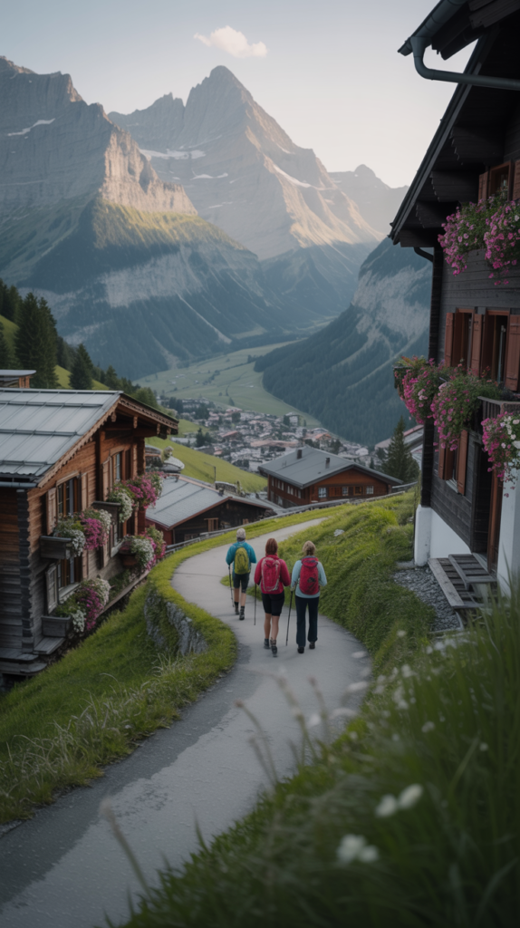
This trail connects Lauterbrunnen with Wengen, a car-free alpine village perched above the valley. You can either hike uphill from Lauterbrunnen or take the cable car to Grütschalp and walk from there.
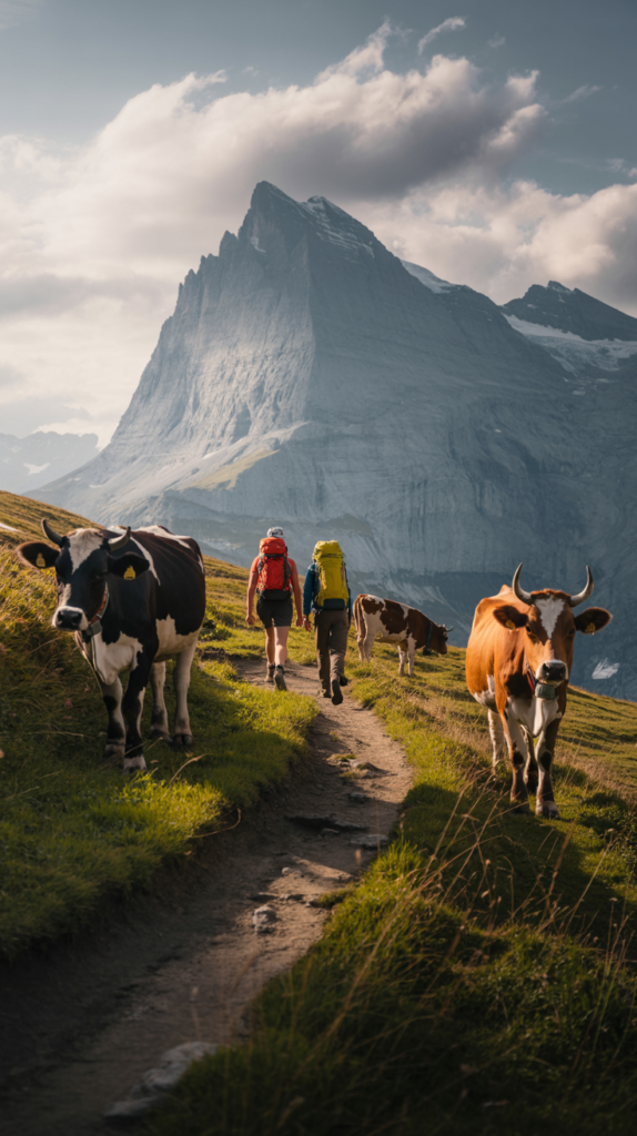
The views along this trail are spectacular think green meadows, grazing cows, and the valley framed by snowcapped peaks. Wengen itself is charming, with wooden chalets, cafés, and viewpoints overlooking Lauterbrunnen.
Why It’s Great: A short hike with a big reward. Perfect for half a day and suitable for families.
Pro Tip: Time your hike to arrive in Wengen for lunch. Try rösti (Swiss potato dish) at a local mountain hut.
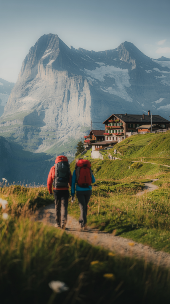
3. Grütschalp to Mürren Trail
Distance: 4.5 km (2.8 mi) one way
Duration: 1.5–2 hours
Difficulty: Easy
Starting Point: Grütschalp (accessible by cable car from Lauterbrunnen)
Highlights: Panoramic views of Eiger, Mönch, and Jungfrau, car-free Mürren village
This is one of Lauterbrunnen’s most beloved trails and perhaps the most scenic short hike in Switzerland. After a quick cable car ride from Lauterbrunnen to Grütschalp, you’ll follow a gently sloping trail through alpine meadows, pine forests, and sweeping views of the snowcapped peaks opposite.
The trail ends in Mürren, a postcard-perfect alpine village perched on a cliff overlooking the valley. Mürren is car-free, which adds to its peaceful charm.
Why It’s Great: Easy, beginner-friendly, and jaw-droppingly beautiful. This is the hike to do if you only have one day in Lauterbrunnen.
Pro Tip: Take the funicular down from Mürren to Stechelberg and walk back to Lauterbrunnen through the valley for a full-day adventure.
4. Mürren to Schilthorn (via Birg)
Distance: 9 km (5.6 mi) one way
Duration: 4–5 hours (uphill)
Difficulty: Challenging
Starting Point: Mürren
Highlights: 360° mountain views, Schilthorn summit (2,970 m / 9,744 ft), James Bond’s “Piz Gloria”
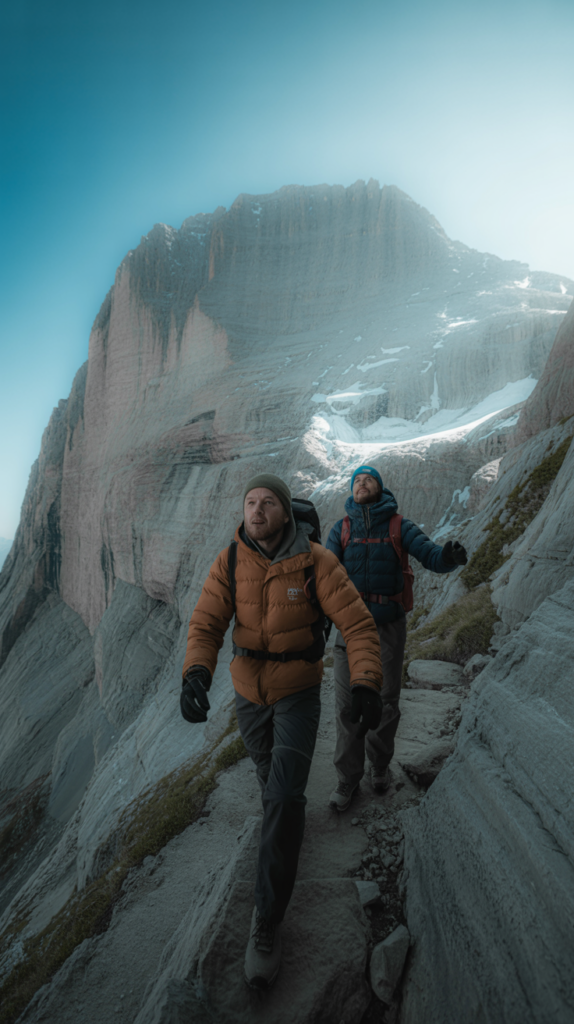
This is one of the most rewarding hikes in the Lauterbrunnen area, but it’s also demanding.
From Mürren, you ascend past alpine meadows, rocky ridges, and finally climb steep paths to reach the Schilthorn summit.
At the top, you’ll find the Piz Gloria revolving restaurant, made famous in the James Bond film On Her Majesty’s Secret Service.
The 360° views from here are some of the best in the Swiss Alps you’ll see the Eiger, Mönch, Jungfrau, and beyond.
Why It’s Great: A bucket-list hike that combines history, cinema, and unmatched alpine panoramas.
Pro Tip: If the full ascent feels too tough, take the cable car part of the way (to Birg) and hike from there.
Read How to Travel for Free When You Have No Money or Budget
5. Lauterbrunnen to Kleine Scheidegg via Wengen
Distance: 12 km (7.5 mi) one way
Duration: 4–5 hours
Difficulty: Moderate
Starting Point: Lauterbrunnen
Highlights: Wengen village, Eiger North Face views, mountain huts
This classic hike begins in Lauterbrunnen and ascends steadily through forests and meadows to Wengen.
From there, the trail continues uphill towards Kleine Scheidegg, a mountain pass that sits at 2,061 m (6,762 ft).
Kleine Scheidegg offers jaw-dropping views of the Eiger North Face, one of the most famous climbing walls in the world.
It’s also the starting point of the Jungfraujoch railway the highest train station in Europe.
Why It’s Great: This trail combines culture, alpine charm, and dramatic mountain views.
Pro Tip: Have lunch at one of the mountain huts along the way, such as the Wengernalp hut, to experience traditional alpine cuisine.
6. Eiger Trail (Eigergletscher to Alpiglen)
Distance: 6 km (3.7 mi) one way
Duration: 2–3 hours
Difficulty: Moderate
Starting Point: Eigergletscher station (accessible by train from Lauterbrunnen)
Highlights: Base of the Eiger North Face, glacial views, alpine meadows
The Eiger Trail is legendary. Starting from the Eigergletscher station, you hike directly beneath the imposing north face of the Eiger.
The trail winds past scree slopes, waterfalls, and alpine pastures, eventually descending to Alpiglen.
The views of the Eiger’s 1,800 m (5,900 ft) north wall are humbling.
This is a hike that connects you with mountaineering history many legendary climbers have attempted (and conquered) this face.
Why It’s Great: A front-row seat to one of the world’s most iconic mountains.
Pro Tip: Bring binoculars you might spot climbers on the wall if conditions are good.
7. Mürren to Gimmelwald
Distance: 2.5 km (1.5 mi) one way
Duration: 45 minutes – 1 hour
Difficulty: Easy
Starting Point: Mürren
Highlights: Alpine farming village, traditional Swiss chalets, peaceful atmosphere
This short but charming trail connects two of Lauterbrunnen’s most famous car-free villages: Mürren and Gimmelwald.
The downhill path passes meadows full of wildflowers, rustic barns, and grazing cows with bells.
Gimmelwald is a tiny village known for its authenticity and slower pace of life. It feels like stepping back in time.
Why It’s Great: Ideal for families, beginners, or anyone wanting a peaceful stroll with gorgeous views.
Pro Tip: Stop at the Gimmelwald Honesty Shop, where locals sell handmade goods and you pay by leaving money in a box Swiss trust at its finest.
8. Schynige Platte Panorama Trail
Distance: 6 km (3.7 mi) loop
Duration: 2–3 hours
Difficulty: Moderate
Starting Point: Schynige Platte railway station (from Wilderswil, near Lauterbrunnen)
Highlights: Panoramic ridge views, alpine flowers, Lake Thun and Lake Brienz
Though slightly outside Lauterbrunnen, the Schynige Platte Panorama Trail is worth including.
After a scenic cogwheel train ride, you’ll arrive at Schynige Platte and follow a loop trail that offers some of the best panoramic views in the Bernese Oberland.
You’ll see both lakes below, the entire Lauterbrunnen Valley, and peaks like the Eiger and Jungfrau.
Why It’s Great: A combination of wildflower meadows and sweeping 360° mountain views.
Pro Tip: Go in July or August for the peak wildflower season.
9. Northface Trail (Mürren Circuit)
Distance: 7 km (4.3 mi) loop
Duration: 3–4 hours
Difficulty: Moderate
Starting Point: Mürren
Highlights: Views of Eiger, Mönch, Jungfrau, alpine huts, educational panels
This themed trail begins and ends in Mürren, circling around the slopes with constant views of the famous mountain trio.
Along the way, informational panels tell stories of mountaineering, geology, and local history.
You’ll also pass several alpine huts where you can grab a drink or snack.
Why It’s Great: A balanced hike that combines education, views, and authentic alpine culture. Pro Tip: Do the loop clockwise for the best sequence of views.
Distance & Duration Summary (Quick Reference)
- Lauterbrunnen Valley Waterfall Trail – 8 km / 2–3 hrs / Easy
- Lauterbrunnen to Wengen Panorama Trail – 5 km / 2 hrs / Moderate
- Grütschalp to Mürren – 4.5 km / 1.5–2 hrs / Easy
- Mürren to Schilthorn – 9 km / 4–5 hrs / Hard
- Lauterbrunnen to Kleine Scheidegg – 12 km / 4–5 hrs / Moderate
- Eiger Trail – 6 km / 2–3 hrs / Moderate
- Mürren to Gimmelwald – 2.5 km / 1 hr / Easy
- Schynige Platte Panorama Trail – 6 km / 2–3 hrs / Moderate
- Northface Trail – 7 km / 3–4 hrs / Moderate
Cost Breakdown for Hiking in Lauterbrunnen
- Accommodation: €60–€250 per night depending on budget (hostels to luxury chalets).
- Food: Supermarket picnic lunch €10–€15; restaurant meals €25–€40.
- Transport: Swiss Travel Pass ~€260/week; Jungfrau Travel Pass ~€250 (3 days). Cable cars cost €10–€30 one way.
- Trail Costs: Most hikes are free. Trümmelbach Falls has an entry fee of ~€12.
Budget travelers can save by staying in hostels or camping, cooking their own meals, and purchasing travel passes.
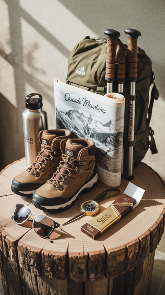
Tools & Lifesaving Gear (Must-Haves)
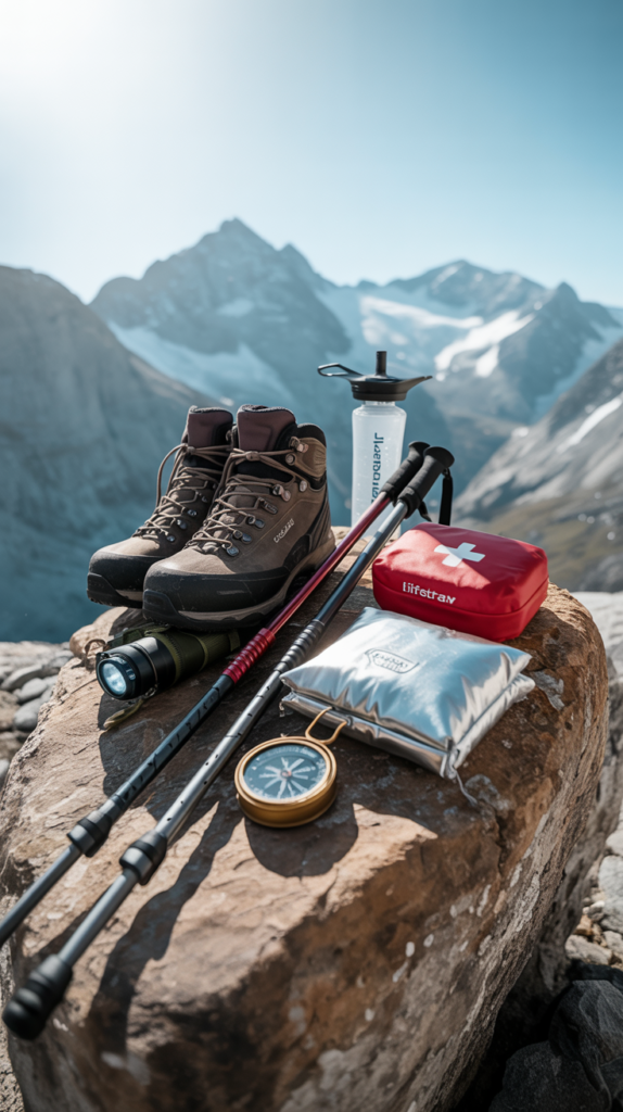
- Hiking Boots: Waterproof with ankle support (e.g., Salomon X Ultra or Lowa Renegade).
- Backpack: 25–30L daypack with hydration system (Osprey Talon).
- Navigation: Map, compass, or offline GPS apps.
- First Aid Kit: Bandages, blister care, painkillers.
- Emergency Gear: Whistle, headlamp, multi-tool, space blanket.
- Trekking pole: Helpful on steep descents (Black Diamond Trail Poles).
- Water Filter Bottle: LifeStraw or Grayl perfect for mountain streams.
Food & Water Prep
- Always carry at least 2 liters (68 oz) of water per person.
- Pack high-energy snacks: trail mix, protein bars, Swiss chocolate.
- If planning a long hike (e.g., Schilthorn or Kleine Scheidegg), pack sandwiches or buy supplies at Coop in Lauterbrunnen.
- Many alpine huts sell rösti, cheese plates, or soup if you want a hearty Swiss meal mid-hike.
Accommodation Options in Lauterbrunnen
- Budget: Valley Hostel (dorms and private rooms, great for backpackers).
- Mid-Range: Hotel Staubbach (fantastic waterfall views).
- Luxury: Hotel Silberhorn (spa, fine dining, central location).
- Alternative: Stay in Mürren or Wengen for a car-free mountain experience.
Booking in advance is essential in summer and autumn.
Pro Tips from Experienced Hikers
- Start hikes early in the morning clearer skies and fewer crowds.
- Always check the Swiss weather app MeteoSwiss for real-time forecasts.
- Respect local farmers close gates, don’t disturb livestock.
- Carry cash for huts and small shops.
- Be prepared for rapid weather changes sun can turn into storm in minutes.
FAQs
1. Are Lauterbrunnen hikes suitable for beginners?
Yes, trails like the Waterfall Trail, Grütschalp to Mürren, and Mürren to Gimmelwald are perfect for beginners and families.
2. Do I need a guide?
Not necessary trails are well-marked. But guided tours are available if you prefer.
3. Can I hike in winter?
Most trails close due to snow. Instead, try winter walking paths or snowshoeing in Mürren/Wengen.
4. Are dogs allowed?
Yes, most trails are dog-friendly, but keep pets leashed near livestock.
5. Do I need hiking insurance?
Yes, it’s wise. Swiss mountain rescue can be very expensive. Get travel insurance covering hiking up to 3,000 m.
Conclusion & Call-to-Action
Lauterbrunnen is more than just a destination it’s a dreamscape for hikers.
From easy valley walks beside waterfalls to challenging climbs with panoramic alpine views, the trails here deliver experiences that stay with you forever.
Whether you’re chasing the roar of Trümmelbach Falls, strolling between Mürren and Gimmelwald, or standing in awe beneath the mighty Eiger, each step brings you closer to the raw beauty of the Swiss Alps.
So, lace up your boots, pack your gear, and set out on one (or all!) of these 9 incredible hikes in Lauterbrunnen. The mountains are calling—will you answer?